
map / 22 April 1965 annotation
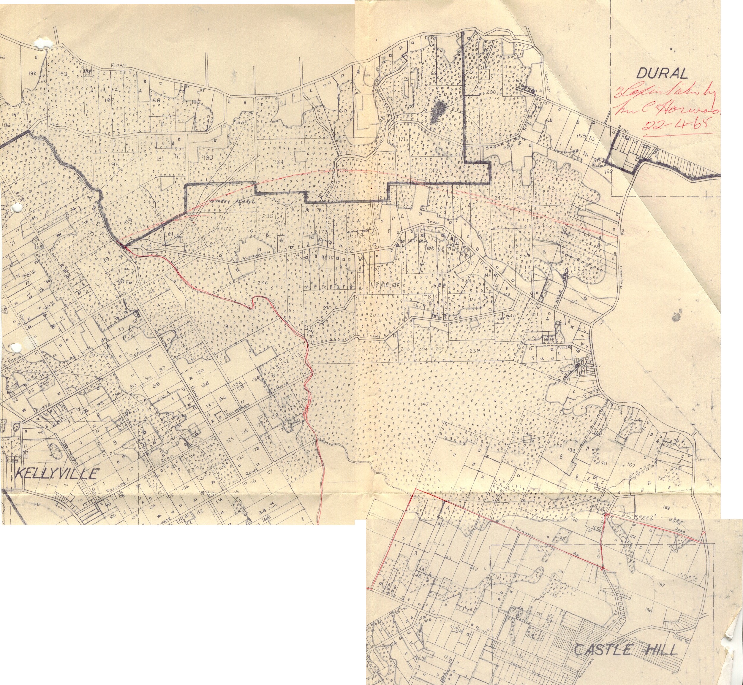
Brigade area marked on a cadastral map
Download original ↗2502 × 2308 pixels
Read alongside the image
Description & visible labels
A description of the visible layout and labels; not a complete text transcription.
DESCRIPTION OF MAP AND LEGIBLE LABELS — not a complete transcription of every lot number.
A joined cadastral map covers Glenhaven between Kellyville, Dural and Castle Hill. It shows roads, property boundaries and numbered lots, with trees represented by repeated small symbols. A red line marks an area boundary; a thick dark irregular line crosses the northern half. The original caption identifies the red line as Glenhaven’s area of operations in 1965 and acknowledges a small missing part.
Large place labels: DURAL; KELLYVILLE; CASTLE HILL.
Road names visible include GLENHAVEN ROAD, KENTHURST ROAD, OLD NORTHERN ROAD, EVANS ROAD, FULLERS ROAD and SHOWGROUND ROAD.
Red handwritten annotation: “3 Copies taken by Mr C Horwood 22-4-65” [first words slightly uncertain].
Numerous cadastral lot numbers and small street labels remain available in the original zoomable image; some are [illegible] at this resolution.