An Interactive Map of the Hawkesbury-Nepean River and How it Floods
The Hawkesbury community is defined by our relationship to its eponymous river.
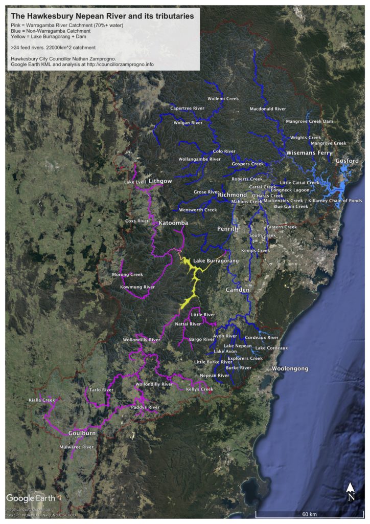
In 2018 I was serving on the Hawkesbury River County Council and I was looking for a map of the whole river system and all the minor rivers, creeks and tributaries that go into it. I couldn’t find one that met my needs.
So, I made my own, drawing from a variety of publicly available geospatial datasets. That version, which requires the Google Earth Pro program can be found here.
However, time has moved on. It would make this information available to a larger audience if there were an interactive, educational website that can be viewed in any (Desktop OS) browser. Here it is:
https://councillorzamprogno.info/hawkesbury_nepean
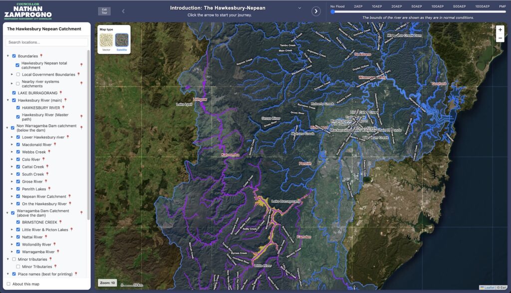
This web version is more elegant and powerful. Crucially, it adds dynamic flood overlay extents courtesy of the 2024 Hawkesbury-Nepean Flood Study.
I would also like to incorporate flood modelling from the Environmental Impact Statement for the shelved Warragamba Dam Raising project, and I am waiting to hear back from the gatekeepers of this data.
You are welcome to use this website for any educational purpose. Please drop me a line if you find it useful.